Map of Brighthelmston, 1779
Published by:
Dan Robertson, Curator of Local History & Archaeology
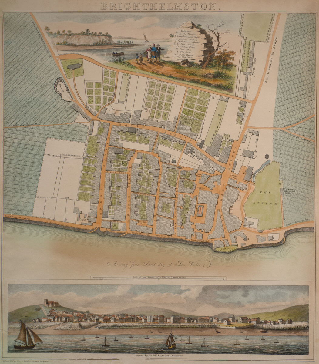
Back when Brighton was known as ‘Brighthelmston’, this beautiful colour map shows how the town was laid out in 1779. But it also reveals much about society in Brighton at this time.
Uncover the story in the exhibit below or view it full screen for the best experience.